Zamani Impact Areas

Data collection and analysis 

Over 400 Amazing Blocks

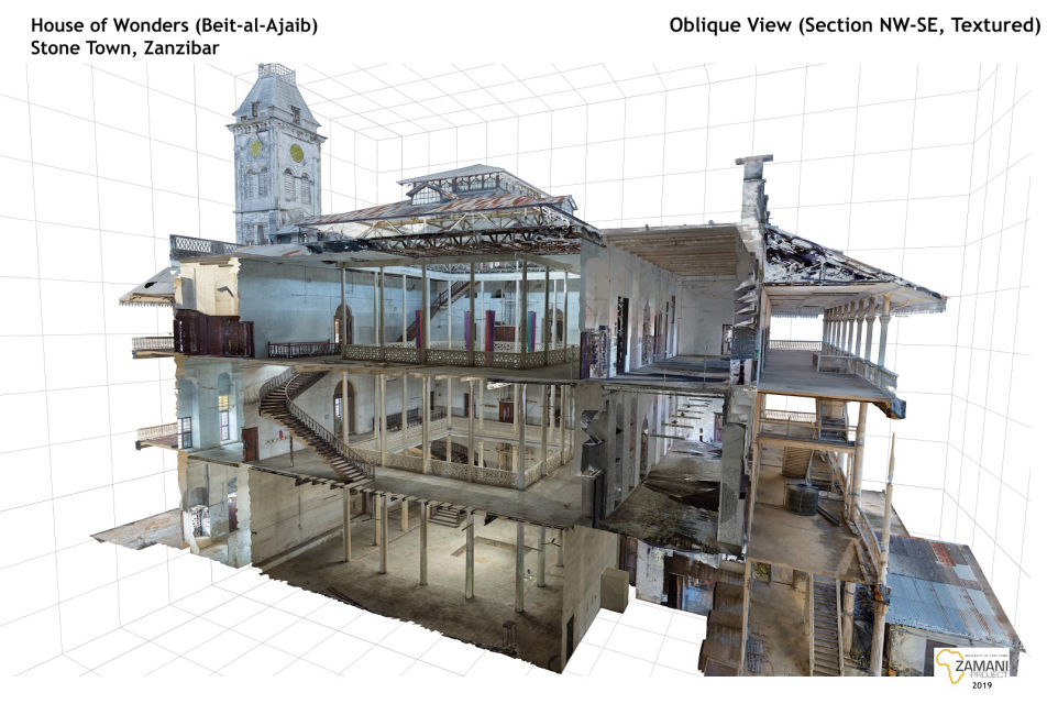
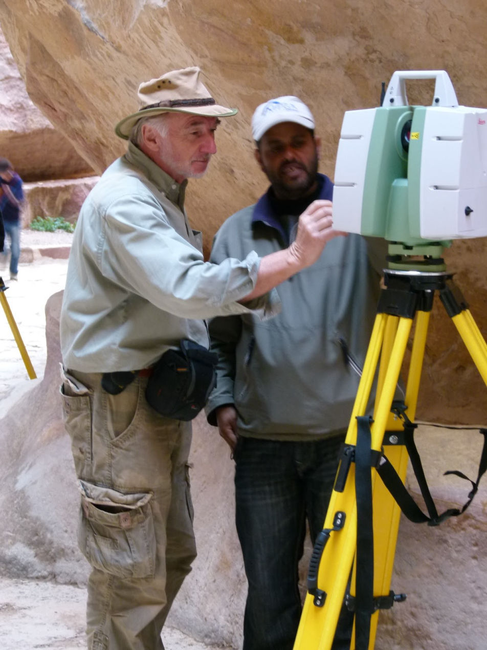
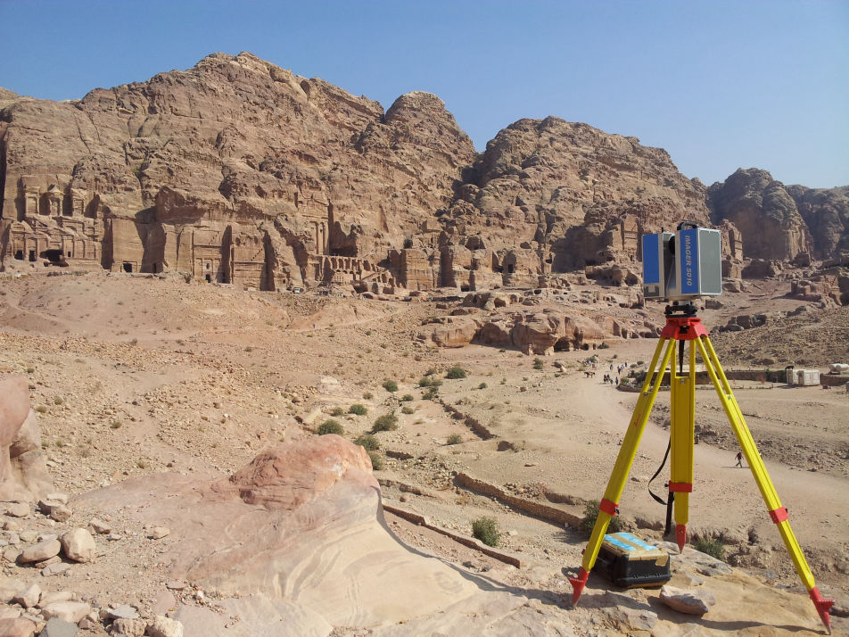
During field campaigns the Zamani Project captures metrically-accurate spatial data using laser scanning and drone and terrestrial photography for photogrammetry, along with, panorama photography and satellite images, ensuring accuracy using control points and GPS/GNNS technology. Through in-house processing the Zamani team then use the data to generate 3D models, Geographic Information Systems, sections, plans, elevations, panoramas and panorama tours, and in turn use these to create site animations and interactive virtual worlds.

As technology advances and data processing accelerates, the Zamani team explores new documentation and visualisation technologies to continually improve the quality of our digital collection and enhance its relevance and accessibility.

Our collection is stored on a secure server at University of Cape Town, and provides a permanent repository of information for use in research and education, restoration, conservation, and site management, and as a record for future generations. 

Heritage communication

Over 400 Amazing Blocks

The Zamani team believes that if people have a love for their heritage they are more likely to protect it. The Zamani team also believe that having access to sites that can move and educate them instills that love and appreciation.

However, gaining physical access to sites can be prohibitively expensive, and having too many people visit a site can compromise the integrity of sacred and important structures and spaces.

Virtual Reality technology provides a safe and cost-effective way towards enabling anyone, anywhere to immerse themselves in heritage sites around the world. We use publications, tours, presentations and applications to encourage people to explore our extensive heritage collections. 

Training and capacity building

Over 400 Amazing Blocks

There are currently not enough trained spatial heritage experts in Africa, and many professionals working with spatial heritage are unaware of evolving state-of-the-art technologies and how to use spatial heritage data effectively.

The Zamani team works to fill these gaps in capacity by promoting the exciting career path of spatial heritage documentation to our interns and postgraduates. The Zamani Project also delivers workshops and training programs to experts in the field, describing the creation of spatial heritage data, discussing its application to a range of fields – such as archaeology, history, conservation, restoration, tourism and urban planning – and promoting the use of specialist analytical tools.

To date the Zamani Project has run courses in heritage documentation and GIS in Ghana, Ethiopia, Jordan, Sudan, Kenya, Tanzania, Mozambique and South Africa. In addition, the Zamani team welcomes opportunities to collaborate with students and staff from local heritage authorities in our field campaigns. 

>> back to the top <<

© Copyright 2021 Zamani Project - All Rights Reserved. Privacy Policy